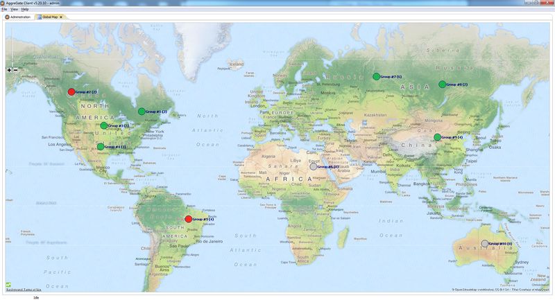
We’ve recently added support for displaying device groups on geographical and topological maps. Devices can be combined into groups and each group is associated with specific geographic coordinates and links to other groups or individual devices.
This new feature allows to design multi-level maps with drill-down capabilities. Imagine a company that provides technical services for Base Telecom Stations in a certain geographical region. Each BTS is a group of devices that includes power management units, security devices, telecom equipment, environment sensors and controllers, etc. Base stations are connected to each other by communication channels, and station-to-station links can be configured through a Topology section of a device group matching each BTS.
 |
Operators get a map that displays stations and their communication channels, as well as overall status of all equipment in each BTS. They can navigate from the map to BTS overview screens and then down to individual device dashboards.
You can get more information about AggreGate Network Manager capabilities here.